Mt Washington- winter edition

I had the opportunity a few weeks ago to do a winter hike of Mt. Washington, the tallest hill in New England and famous home to “the worst weather in the world” (and New Englanders know all about bad weather).  I had hiked it once before in the summer, and found it to be a fun, moderate hike, except for the part where we had to help with the rescue of a collapsed hiker.

Yep, that was a good one.

Anyways, from a technical standpoint, a winter climb of Mt. Washington is much more committing and difficult, and one of the closest things that New England has to offer for a true Alpine experience.  I brought (and used) crampons and an ice axe, and consumed what I would estimate to be several thousand calories in the 7 hours that we were on the mountain.

I hiked with two other grad students, David and Katherine, (both from Harvard) that I had met through the MIT outing club.  We spent the night at the MITOC cabin near North Conway, so we were able to get a reasonably early start on Saturday morning- according to the ranger’s logbook, we were the second party to have left the trailhead that morning (at around 7:00 am), the first group having apparently left at 2:30 am for a sunrise on the summit, although we were leapfrogging most of the day with a group of 9 older dudes from the Mansfield area.

The Lion’s head winter route had just opened earlier that week (it’s been an unusually low snowfall year in New England), so that was the route that we took.

There were some areas where the cover was a little thin, making it harder to get good purchase with our crampons, but otherwise the conditions were great!

As we broke above treeline (around 9:30 am), we were rewarded by more sunshine and surprisingly little wind- a rare happening on Mt. Washington in the winter.  The day was so clear we could actually see all the way to the Atlantic Ocean, some 70 miles in the distance.

As we gained Lion’s Head and passed through Split Rock, we could see the headwall of Tuckerman’s Ravine off to our left.  Another goal of mine to ski Tucks at some point, although today was not the day for it- VERY thin cover, and just a week prior there had been a scary avalanche.

We were breaking trail, so there were sections where we were postholing through snow drifts.  The Mansfield Geezers dogged our nicely cut steps the whole way, and then passed us about 100 feet short of the summit.

Rascals.

The summit cone was (not unexpectedly) windy, but relatively tame for Mt. Washington, with gusts < 40 miles per hour.  With wind chill the temperature was around -10F, which, while balmy for the summit in January, is still cold.  I took my liner gloves off for about 5 minutes to eat lunch, and when I tried to put them back on I found that my sweat had infiltrated the fabric and then frozen, rendering my gloves unwearable until I could melt ’em enough to fit back on my hands.

After a couple more photos and chocolate bars at the summit we headed back down.  We were at the summit by 11:00 AM and back in the car by 2 PM, which is a pretty great pace! Despite the snow and ice, it was actually much faster than my pace when I hiked in the summer, even discounting the ~3 hour Good Samaritan delay.   Another group from MIT that went up around the same day broke the hike up into two days (camping out on Boot Spur somewhere), and didn’t get back to their cars until 6 pm or so on the second day, meaning that they spent ~36 hours on the mountain, which sounds… cold.

All in all, a wonderful time, and some of the most fun I’ve climbing in the East.  After we descended we stopped in town and utterly demolished a couple of large Flatbread pizzas.


Forbidden Peak Fail and the Tatoosh Traverse

Last summer, when I returned to the US after close to a year in India, I briefly flew out to Seattle to visit some family.  While I was out west, I was seized by a hankering for more mountaineering, and I talked Eric, a family friend from Portland, into trying to climb Forbidden Peak, a prominent mountain in the North Cascades National Park.

The plan was that we would drive up, hike to a base camp just above treeline, and then the next day hike up over a small glacier and begin the rock climbing up to the summit.  Because there was both a significant snowfield crossing and technical (trad, of course) rock climbing, we would need carry in addition to the usual stuff a tent, crampons, ice axes, harnesses, a rope, helmets, a rack, and sleeping bags- so our packs were around 40 pounds each.
Despite growing up in Portland, I had never been to the North Cascades before, and I was taken aback by the beauty of the place.  The mountains are referred to as the American Alps, and with good reason- the rugged peaks and hanging glaciers rivaled anything I have seen in the Alps.  Many of the climbs in the North Cascades are named for items and locations in Middle Earth, and the whole place has a very Tolkein-esque vibe.

We made it to our base camp shortly before sunset, and were treated to great views- and ominous clouds.

One of the reasons that the North Cascades don’t get as much traffic as the actual Alps is that the weather in most of the Northwest (and this I can attest to) is perpetually rainy. However, the summer of 2015 was one of the driest summers in the history of the Pacific Northwest.  For the first time ever, the Olympic rainforest caught fire.  Snowpacks were at a record low, and temperatures in the Seattle-Tacoma area were pushing 100 degrees F.

And yet…

for the 8 hours that we needed it to be dry, a rainstorm popped up out of nowhere and sat on top of the northern half of Skagit county, soaking us and reducing the visibility to nothing.  This photo was taken from the same place as the above photos:

IMG_0046[1]

In an effort to reduce the amount of weight we were carrying, we had left the rain fly at home. Classic!

We stayed in the tent – with water sluicing through the ceiling – until around 7, then packed up and bailed.  We made it back to the car a few hours later, mud-splattered and forlorn.

IMG_0047[1]

After spending a day drying out our gear in my grandma’s lawn, we drove down to Mt. Rainer National Park to hike the Tatoosh traverse, an extendable scramble over several of the lesser peaks within the park boundary.

Since we were both still cranky about having carried heavy packs of crap we never got to use up and down the Cascades, we opted to go ultralight on the Tatoosh traverse, carrying little besides food and water, which meant eschewing ropes on the 4th and easy 5th class summit blocks of each of the peaks.  YOLO!

The weather could not have been more different than in the North Cascades- instead of fog and rain, it was clear and blisteringly hot, even up on the ridge.  The views of Mt. Rainer were absolutely spectacular.

IMG_0051[1]

IMG_0066[1]

The trail was not particularly well marked, but we guessed that we had hiked somewhere between 12 and 20 miles, with many, many thousands of feet of elevation change.  On the drive out we discovered a railroad diner that serves excellent blackberry smoothies.


Mysore and Hampi (climbing in India!)

“You step on to the road, and if you don’t keep your feet there’s no knowing where you might be swept off to”

Because of the holiday of Dusserha, I was able to take a few days off and do some more travelling through south India (before coming to Jharkand).  What I had originally intended as maybe a leisurely trip to Bangalore and back quickly and somewhat to my surprise turned into a whirlwind tour of Karnataka.

OLYMPUS DIGITAL CAMERA

I started in Madurai, took an overnight bus to Bangalore, then went to Mysore.  After two days in Mysore, I traveled to Hampi (for climbing!!), and then finally back to Madurai with another day stopover in Bangalore.  Google maps puts this at 29 hours of travel, but on Indian buses during public holidays it took considerably longer.

I was fortunate enough to be able to travel with a few other Fulbrighters as well. Alice, another Fulbright-Nehru researcher, lives in Bangalore and is a fellow climber, and was with me for many legs of the journey.  Alice has an amazing project in India, and is a much better photographer than me, so you should check out her awesome photo blog.

In Mysore I stayed with Molly and Lars (and their daughters Tess and Willa), who are University of Portland professors teaching at the University of Mysore on Fulbright scholarships.  They keep an excellent blog as well!

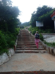
Alice stayed at a facility owned by her organization, while I crashed at the Larsen household.  We started the next day by climbing Chamundi Hill, an series of 1,000 steps that lead to a large Nandi (Shiva’s servant, a bull) statue, a Shiva cave temple, and finally a large temple.

OLYMPUS DIGITAL CAMERA OLYMPUS DIGITAL CAMERA

 OLYMPUS DIGITAL CAMERA

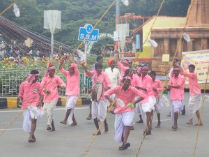
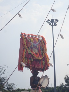
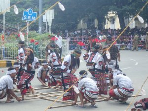
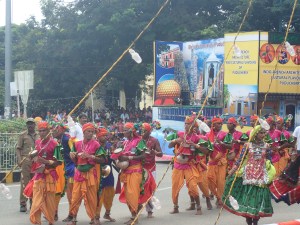
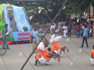
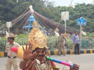
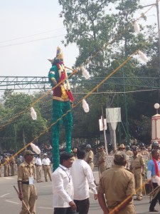
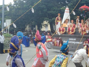
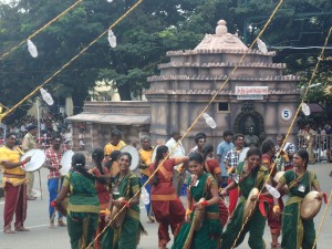
Molly and Lars’s department chair at the University of Mysore was able to squirrel all six of us into a special, reserved ‘foreigner’s section’, which was right up against the procession route. Because of the recent death of the King of Mysore, the parade was apparently a little subdued this year, but it certainly seemed impressive to me!   Musical and dance acts representing almost every part of India came by: acrobats from Karnataka, drummers from Maharashtra, cheerful Punjabi bhangra dancers, stilt walkers and many, many more, as well as large floats, marching bands, many elephants, and a small cavalry troop.

OLYMPUS DIGITAL CAMERA OLYMPUS DIGITAL CAMERA

OLYMPUS DIGITAL CAMERA OLYMPUS DIGITAL CAMERA

OLYMPUS DIGITAL CAMERA

OLYMPUS DIGITAL CAMERA OLYMPUS DIGITAL CAMERA OLYMPUS DIGITAL CAMERA OLYMPUS DIGITAL CAMERA

OLYMPUS DIGITAL CAMERA OLYMPUS DIGITAL CAMERA OLYMPUS DIGITAL CAMERA OLYMPUS DIGITAL CAMERA OLYMPUS DIGITAL CAMERA OLYMPUS DIGITAL CAMERA

OLYMPUS DIGITAL CAMERA OLYMPUS DIGITAL CAMERA

 OLYMPUS DIGITAL CAMERA

A note on Indian crowd safety

The US, and Rhode Island in particular, have pretty strict crowd control rules. These restrict the number of people that can be in a certain area, and provide standards for the number of accessibility of entrances and exits.  Needless to say, these sorts of rules are not adhered to in India.   For the Mysore Dusshera procession, some 800,000 people swarmed the streets to watch the parade, press up against (and often jumping over or under) the makeshift barricades.  An army of khaki-clad police officers repeatedly pushed the crowd back with lathis (batons), and the shoving matches could get ugly at time.  When the parade ended, it seemed like all 800,000 people tried to leave at the same time- jumping over walls, knocking down fences, etc.  Some real excitement for a few minutes there!

OLYMPUS DIGITAL CAMERA

A scary moment from the Dussehra procession: as a mass of people rushes against the barricades, a police officer hauls children out from the crowd while his colleagues beat back those around him.

I think an American fire marshal would have had a stroke on the spot.

(Although to give credit where it is due, the Providence Fire guys I worked with would have succumbed to apoplexy before making it off the plane. ZING!)

GOLDEN BOULDERS

Hampi is well-known for both its climbing opportunities and history.  Formerly known as Vijaynagara, Hampi was the seat of the large Vijaynagar Empire until it was besieged and sacked in the 1560s.

OLYMPUS DIGITAL CAMERA

The main temple at Hampi- about 500 years old

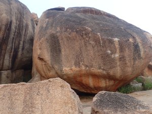
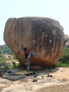
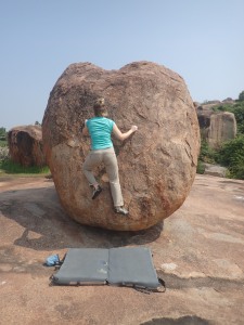
Surrounding the ruins (across the river from the old city), are seeming endless boulder fields- a famous destination for bouldering!  The local story is that the Vanara (monkey) army of Lord Rama had camped here, and threw the rocks around to show off their strength. They would later manually build a land bridge to Lanka and then besiege and defeat the demon hordes of Ravana, so I guess it was important to properly warm up first.

Anyways, Alice and I took an overnight bus from Mysore to the neighboring town of Hospet (discovering the true meaning of a ‘semi-sleeper’ bus), and then an auto-rickshaw from Hospet to Hampi, where we rented rooms and crash pads.

OLYMPUS DIGITAL CAMERA

OLYMPUS DIGITAL CAMERA

OLYMPUS DIGITAL CAMERA OLYMPUS DIGITAL CAMERA

OLYMPUS DIGITAL CAMERA OLYMPUS DIGITAL CAMERA

OLYMPUS DIGITAL CAMERA

# Highball

OLYMPUS DIGITAL CAMERA

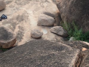
“So to descend, hop the gap to the next boulder [about 30 ft off the ground), and then chimney down on the opposite wall” #highball

OLYMPUS DIGITAL CAMERA

OLYMPUS DIGITAL CAMERA

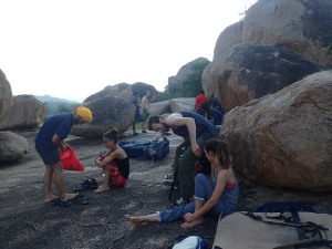
Most of the folks in the climbing areas at Hampi were British or Israeli- not to many Americans.  If you are get to Hampi with the intention of climbing, ask for Tom and Jerry: they are local guys (dang good climbers) who run a small shop and have lots and lots of insider knowledge of the area.  They can rent you crash pads (and shoes and chalk) for a few hundred rupees.

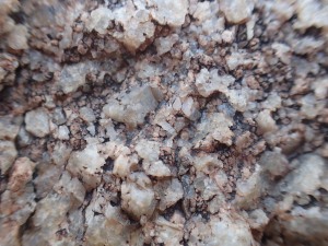
The rock was really, really amazing, but super sharp (granite, I believe- it felt a lot like Lincoln woods in RI).  Two weeks later my fingers are still healing.

OLYMPUS DIGITAL CAMERA OLYMPUS DIGITAL CAMERA

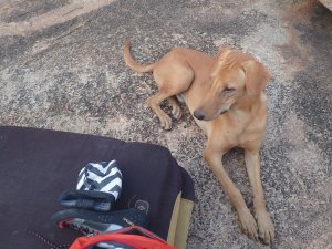
We didn’t actually see any, but we heard lots of warnings about snakes.  We did find a friendly stray dog who kept us company most of the time we were at the crag:

OLYMPUS DIGITAL CAMERA

WOOF

It was also nice to just be able to relax.  It was too hot during the day to climb, so we would climb for a few hours in the morning, and then come back and eat a leisurely brunch and generally be lazy until it cooled down again in the afternoon. This was the view from my room:

OLYMPUS DIGITAL CAMERA

Wilderness Medicine- A Tale from the Road

EDIT: If you are here from backpacker.com, I really have no idea how this post ended up as a comment on the Bright Angel Trail article!  This post is about an incident in New Hampshire. But if you are planning on hiking in the Grand Canyon, I might recommend the Hermit Creek trail 😉 

I had wanted to share this story after it happened a few months ago, but I waited a while so that there could be a little more ambiguity about exactly when it happened, as well as the identities of those involved.

I was hiking Mt Washington with my friend Eva one weekend this past summer. Mt. Washington is an approximately 6,300 foot tall hill/mountain in New Hampshire, the tallest in New England. In the winter, it is famously home to the ‘worst weather on Earth’, but in summer it is a popular hike- about 4.2 miles and 4200 feet elevation change each way by the easiest route. Having grown up in Oregon, I can be a little snobby about what constitutes a mountain (Mt. Hood is 11,400 feet tall, and is capped by imposing glaciers; Mt. Washington is half of that and capped by a road and a railway), but it was a warm day and Mt. Washington is certainly no sidewalk- I was sweating heavily by the time we reached the summit, about four hours after starting from Pinkham Notch.

We were coming down from the summit, and were about .7 miles along the trail when we saw an older gentleman keel over on the side of the trail and start vomiting into the bushes- probably about 10 feet from where I was standing. We introduced ourselves to the man’s companions (his brother and their friend, we later found out), and said that we both had our WFRs (wilderness first responder training), and asked if they needed any help. Their response: “He’s all yours!”

I said to myself: here goes!

I started on the ABCs – checking airway, breathing, and circulation – while Eva worked to keep the trail from getting too congested and give us some privacy. Mt. Washington apparently attracts massive crowds on sunny weekend days, and the trail was pretty narrow in this spot. We were joined shortly thereafter by a passing nurse practitioner, who sent her companions on ahead to go get help from the summit area. The three of us continued through the patient assessment. Our patient was in his sixties, fully alert and oriented (AOx4), with a pulse of 164 strong and regular, respiratory rate 14, and pink, warm, and dry skin. His speech was really soft and somewhat disjointed, so getting his medical history was proving difficult. Fortunately, his brother was able to help us out, and he gave us a small laundry list: no allergies, no history of diabetes; but medication for a thyroid disorder, high blood pressure, and high cholesterol; a history of prostate cancer, and family history of heart disease. Right on cue, our patient turned white, fell back and started clutching his left arm.

I said to myself: Oh ****.

I was closest to his head, so I dove somewhat instinctively to support his neck and head and keep him from hitting rocks and/or rolling off the trail. I suffered a few very long seconds of horror thinking that my patient was suffering from a heart attack! Known as a myocardial infarction, or MI, heart attacks are often preceded by feelings of malaise, nausea, and severe, crushing, pain radiated up the left arm. If this man was having a full-blown MI, then he was going to die in front of me, and nothing I could do would change it.
However, he then switched to grabbing his legs, and then other arm.  No crushing chest pain, he said, just severe muscle cramps in all four of his limbs.  I started to breathe again. Additionally, our patient complained of feeling nauseous and weak, “as if all the energy had been drained from him”, that his hands wouldn’t stop shaking, and that he had stopped sweating some time ago. We then found out the he had run out of water “a while back”, and had only eaten a small bowl of oatmeal and a granola bar (this was at 12:30 pm, 3.5 miles and 3000 vertical feet from the Pinkham Notch trail head) since getting up at 6 am. He hadn’t used a bathroom all day. We also found out that this was his first hike… ever.

These symptoms can be caused by a number of ailments (heart disease was not entirely out of the realm of possibility, but the odds of that were looking lower and lower), but are classic signs of dehydration and heat exhaustion. Sweating removes both water and salt from the body, and both are critical for the body’s continued function. Dehydration, coupled with heavy exercise and heat can cause all sorts of unpleasant effects- most of which our patient was currently experiencing. Left untreated, dehydration can be fatal (ask any Grand Canyon Park Ranger), but usually people will start to feel sick and debilitated long before it becomes a life threat.

Because of the nausea, our patient was pretty unwilling to eat or drink anything, but we talked him into sucking down some Gatorade, apple slices, and trail mix (the nurse was awesome at getting him to eat and drink- I was really glad she was there) while Eva and I switched off monitoring his vital signs. It still took nearly an hour and half for him to drink 16 ounces of Gatorade, but he seemed to improve a little after each sip and eventually worked his way up to fruit and chocolate. His pulse, which started at 164, remained at 140 for about 30 minutes, and even after that never dropped below 96 in the whole time I was with him. 140 – 160 beats per minute is not unreasonable for someone actively climbing Mt. Washington, but it was a little concerning to see it remain so high for so long.

The water, food, and rest, made an astonishing difference. After two hours and another half-liter of water, the patient could stand without assistance, speak clearly, and even start walking, although he was still suffering from debilitating leg cramps. The nausea and shaking had also gone away. The scope of practice for WFRs and wilderness EMTs (i.e. the number of medicine-related things I know how to do) is not large , so it was good to see something that could actually be treated in field! When I worked on an ambulance in Providence we were always at most 15 minutes from the hospital, so I never got to see a patient improve this drastically. After all, I thought at one point that he was dying- and now he was animated and chatting about his children.

We had no cell service where we were, so it took 2.5 hours for an EMT from NH Fish and Game (New Hampshire’s forest service/park ranger organization) to find us- a good reminder of how long it can take to get help, even on a trail with literally hundreds of hikers, and a sobering reminder of how screwed we would have been if it had indeed been a heart attack. A side trail lead to road access about a mile away with little elevation change, so our patient and his companions were actually able to walk out (with the Fish and Game EMT in tow), although not before giving us warm hugs and exchanging contact information. The EMT gave them a ride from there back to Pinkham Notch and some advice about sufficient fluid intake.

Eva and I hiked out, feeling pretty pleased with ourselves. As part of an effort to keep our own electrolytes in balance, we stopped for donuts on the way home.

Tamil in Paris? + Some climbing

Tamil… in Paris?

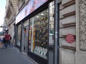
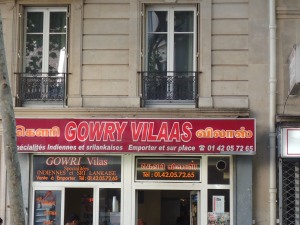
I was in Paris last week with my parents (celebrating, among other things, my mother’s birthday) when I saw the following in Rue Faubourg de Saint-Dennis:

Rue Faubourg Saint-Dennis

Not only does Paris have a Little India, but it almost entirely Tamil speaking! Quick aside: Tamil is one of India’s 22 national languages.  It is spoken primarily in the south (especially in Tamil Nadu state), but has a significant diaspora.

Anyways, France actually has a historic connection with India.  Pondicherry (Puducherry) was for a long time a French colony, and the city still has a vibrant French quarter.  Pondicherry is not technically in the state of Tamil Nadu, but most people are ethnically (and linguistically) Tamil.  Additionally, many Tamilians came to Paris from Sri Lanka, often to avoid the brutal, 25-year-long Sri Lankan civil war (1983 – 2009), which was fought between predominantly Tamilian LTTE forces and the Sinhalese-majority government.

Rue Faubourg Saint-Dennis  Rue Faubourg Saint-Dennis

It was pretty fun to watch Rue Faubourg in action!  The people were often dressed like any other Parisans, but almost entirely ethnically Indian- and behaving like Indians.  We were there on a Sunday in August (the European holiday month), so many of the shops were shuttered, but the streets were packed.  Young men hung out on the street, laughing and yelling in Tamil, and holding hands (although Indian cultures tend to promote segregation between the genders, Indians are openly affectionate with members of the same sex: holding hands between men, for example, is common and merely a sign of friendship).  Older men sat at the street corners and chatted, or simply chewed paan and smoked.  As is typically in India, there were fewer women on the street, but the ones who were there also spoke rapidly to one another in (exclusively) Tamil as they went about their errands. Despite an article to the contrary, it felt also felt quite safe (more so than many other regions of Paris), even after dark.

For anyone in the areas or planning to pass through Paris, I would highly recommend checking it out!  Many of the restaurants offer great authentic South Indian food, for prices that are relatively cheap (compared to rest of Paris anyways).  The Little India area is located around Rue Faubourg de Saint-Dennis, in the 10th arrondissement, and easily accessible by bus (# 42) and the mètro.  

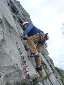
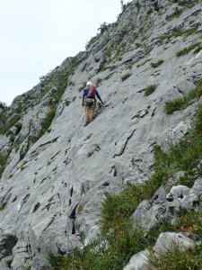
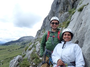
After Paris, we spent a few days in Geneva.  Geneva is a really amazing and beautiful city, which has hands-down the best public transport system I have ever seen (MBTA, I love you, but you need to get your act together here).  Mom and I went rock climbing one day in the Chamonix area, which was awesome- the French limestone was totally different than anything else I’ve been on. We went with a guide (a friend of one of mom’s colleagues), and did a 7 pitch route called Manque un Mètre.  See the photos section for more pictures!

Leading the crux pitch  Climbing in Chamonix Sebastian and I 

 Climbing in Chamonix  Mom and me at a rappel station

By the end of tomorrow I’ll be in New Delhi!